Marine Survey
Marine Survey
Various surveys undertaken by dedicated expert operators
-Marine Survey by NTT-WE Marine-
We provide a marine survey service that makes use of a variety of equipment and machines that we have on hand. Before finalizing the cable laying route, it is necessary to conduct a detailed survey. We introduce facilities and survey methods to investigate the seabed and what lies beneath.
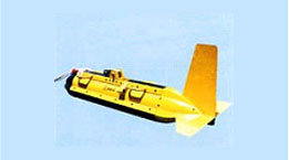
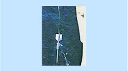
Equipment
Purpose of the Survey
Based on the marine survey, the appropriate route for laying the cable (with minimal rocks and with a gradual incline) is identified and the optimum route of the cable is determined.
![]() Survey for cable laying (Seabed Surface Survey)
Survey for cable laying (Seabed Surface Survey)
Multi-beam depth finder is used to survey the topography of the seabed. With the multi-beam depth finder, it is possible to survey a width of a few kilometers at a time and create a topographical chart of the seabed by processing the data using a computer. With the latest multi-beam system, the surface soil quality distribution of the seabed can also be analyzed from the intensity of the refracted sound waves from the seabed.
![]() Survey for cable burying (Seabed Sub-Surface Survey)
Survey for cable burying (Seabed Sub-Surface Survey)
A survey is conducted to investigate the sub-surface geological layer distribution and the thickness of the sedimentation layer using side-scan sonar and sub-bottom profilers (geological layer survey, *1) for sections that require the cable to be buried. These surveys use lower sound frequencies than those used for the seabed surface survey. In addition, piston core samplers (*2) are used to collect soil samples at regular intervals to ensure that the soil is being investigated correctly.
Surveys the soil quality distribution of the seabed using low-frequency sound waves. Effective in the search of wide areas, such as looking for sunken vessels or the debris of aircraft that may have gone down.
Used to collect seabed soil samples, it is allowed to freefall to the sea floor and it and penetrates the seabed under its momentum.
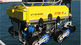
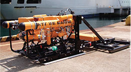
ROVSTAR
ROVSTAR is able to travel to any location in Japan, accompanied by its specialist expert operator.
Underwater Photography
We provide photographs that range from fish breeding reefs and seabed conditions to existing cable and pipeline conditions using our ROV.
Surveys of Buried Items & Magnetic Surveys
Surveys using detection sensors to locate metallic objects, cables and other items that are buried beneath the seabed
Burying of Seabed Facilities.
We can bury items such as cables that have already been laid or pipelines etc. using a water jet system.